- Services
- Industries
- Team
- Company
- Articles
- Case Studies
- RUN FREE PILOT
Geospatial Annotation Services for Spatial Data Analysis
Our geospatial annotation services prepare your spatial data for customized geospatial models/applications, including GIS, navigation, urban planning, and more.
contact us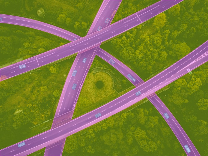
We Scale Teams for:


Data Annotation for Geospatial Technology at Label Your Data
Based on our experience, the main focus of labeling geospatial data is mostly mapping industry, however, we also performed geospatial data annotation for air defense and agricultural applications. Our annotators can handle different types of spatial data, such as maps, satellite images, GPS data, weather data, cell phone data, or social media data, as well as various types of geospatial data annotation techniques.
Data annotation for geospatial technology at Label Your Data supports a wide range of projects that rely on spatial information. Our clients can leverage their data for developing advanced geospatial models for geographic information systems (GIS), navigation, urban planning, etc. We also handle intricate edge cases and can readily adjust to your changing annotation instructions or approaches, collaborating closely with you. The expertise and dedication of our annotation team in geospatial annotation service ensures your mapping endeavors in AI are successful and hassle-free.
Our Data Annotation Services for Mapping Industry Projects
In the area of data annotation for the mapping industry, Label Your Data has the opportunity to demonstrate its extensive knowledge in computer vision projects. Our global annotation team can deliver the following geospatial annotation services (but we are always ready for custom annotation tasks):
Bounding Boxes for Satellite Imagery
Semantic Segmentation for Roads
Polygonal Annotation for Solar Energy and Agriculture Tasks
Polylines and Keypoints for Other Applications

We performed bounding box annotation to pinpoint rooftops and various objects within satellite images. These annotations are used for object detection and localization tasks.

Our expertise extends to semantic segmentation, enabling the accurate identification and classification of different road components, vital for road mapping and navigation applications.

Our annotators delivered accurate annotations of solar panels on buildings and crops in agricultural settings using polygons. This type of data labeling helps define the exact boundaries of these elements, facilitating analysis and monitoring.

While less common, we also offer annotation services for polylines and keypoints when your project demands more specialized data representations.
Bounding Boxes for Satellite Imagery

We performed bounding box annotation to pinpoint rooftops and various objects within satellite images. These annotations are used for object detection and localization tasks.
Semantic Segmentation for Roads

Our expertise extends to semantic segmentation, enabling the accurate identification and classification of different road components, vital for road mapping and navigation applications.
Polygonal Annotation for Solar Energy and Agriculture Tasks

Our annotators delivered accurate annotations of solar panels on buildings and crops in agricultural settings using polygons. This type of data labeling helps define the exact boundaries of these elements, facilitating analysis and monitoring.
Polylines and Keypoints for Other Applications

While less common, we also offer annotation services for polylines and keypoints when your project demands more specialized data representations.
High Precision
Ensuring pinpoint accuracy in data annotation for aerial imagery is paramount for us. We flag challenging cases (when objects are hard to recognize), enrich instructions, and maintain strict guideline adherence, elevating data quality for more accurate and insightful satellite image analysis.
Industry Expertise
Given the intricate nature of satellite imagery, our team leverages its industry expertise to help geospatial models detect and track objects, as well as extract real-life objects within these images. This provides a more comprehensive understanding of geophysical events in various locations.
Flexible Collaboration
Our skilled annotators are adept at working with various annotation tools, recognizing that certain satellite imagery demands specialized technology. Additionally, we provide flexible quality assurance (QA) methods, such as cross-reference annotation or incorporating additional confidence attributes as needed.
Why Choose Data Annotation for GPS Mapping at Label Your Data?
Our company holds certifications for PCI DSS (level 1) and ISO:27001, and we adhere to the regulations outlined by GDPR, CCPA, and HIPAA. With 10+ years of experience and 500+ specialists on board, we provide customized data annotation for mapping industry for enterprise and R&D projects in 55 languages.
Our Success Stories
Differentiating rooftop objects in low-quality images.
Collaborative refinement of labeling guidelines with real-time feedback tool.
Geospatial Annotation for Carbon Monitoring
In partnership with an Australian agency focused on accelerating carbon abatement, we undertook a short-term project involving 3000 satellite rooftop images. Our task was to accurately label solar panels, water heaters, and other equipment, distinguishing between different objects on the roofs. Challenges arose due to image quality variations, necessitating close Client collaboration for handling edge cases. We enhanced labeling guidelines and provided our tool for real-time label review and feedback. This ensured precise identification and alignment with the Client’s objectives.
Managing the subjectivity of landfill detection cases during model validation.
Implementing cross-reference quality assurance with confidence scoring.
Satellite-Based Landfill Detection Model Validation
We conducted model validation for a US university, specifically assessing their landfill detection model utilizing satellite imagery. Our process involved verifying the accuracy of landfill detections based on provided coordinates. Given the subjective nature of many cases, we implemented a cross-reference QA approach, involving two annotators assessing the same data. Notably, annotators assigned confidence scores when uncertain about a label. What sets this project apart is our on-demand model, allowing the client to pause between annotation iterations to continually test, refine, and enhance their model.
Adhering to stringent security and data-sharing restrictions within military object detection from satellite imagery.
Integration with client’s annotation software and formation of a dedicated team.
Geospatial Annotation for Military Defense
For a military defense project, we leveraged satellite imagery to train the model for the precise identification of specific military assets. This demanded not only a high degree of accuracy but also a comprehensive grasp of specific military classifications. Additionally, the Client required strict security adherence, necessitating the integration of our solution into their annotation software and the establishment of a dedicated, trusted team to handle the sensitive data, ensuring utmost confidentiality.
Our Recent Articles
Send your data to us and get a free pilot
project!
CONTACT NOW
FAQs
What is GIS data annotation and its role in geospatial applications?
Data annotation of Geographic Information Systems (GIS) involves labeling and adding context to geographic information, enhancing the utility and interpretability of geospatial data for various applications.
How does data annotation for the mapping industry contribute to the accuracy and usability of geospatial data?
Data annotation for geospatial technology involves the process of labeling and enriching geospatial data with information, such as landmarks, terrain features, and infrastructure details. This, in turn, enhances the precision and utility of geospatial tech applications like GPS navigation and location-based services.
Why is data annotation for geospatial projects considered essential in the improvement of ML models used in these applications?
A geospatial annotation service, through precise geotagging, enables the creation of datasets that distinguish geographic features, ensuring the proper functioning of machine learning models. Enriched data with accurate geographical context is then used for the development of applications such as location-based services, geospatial analysis, and navigation systems.
What are the best practices in data annotation for GPS mapping projects?
Best practices in data annotation for GPS mapping projects involve using a combination of manual and automated annotation methods to ensure high accuracy and consistency in the process. Another factor to consider is employing skilled annotators with domain expertise, like the Label Your Data team.