-
Services
computer vision
self-serve
- Industries
- Pricing
- About
- Careers
-
Resources
- talk to us
Trusted by 200+ Customers


Who We Serve
ML Engineers
Time-consuming annotation workflows delay model training.
Need scalable tools for large geospatial datasets.
Data Scientists
Struggle with accuracy in complex geospatial data.
Require a balance between automation and manual input.
GIS Experts
Face challenges with multi-layered data labeling.
Deal with integration issues with GIS systems and data formats.
Dataset Providers
Require precise annotations for client-ready GIS datasets.
Need efficient workflows to meet deadlines.
Check Your GIS Labeling Needs


Gain accurate land use insights with annotated data.
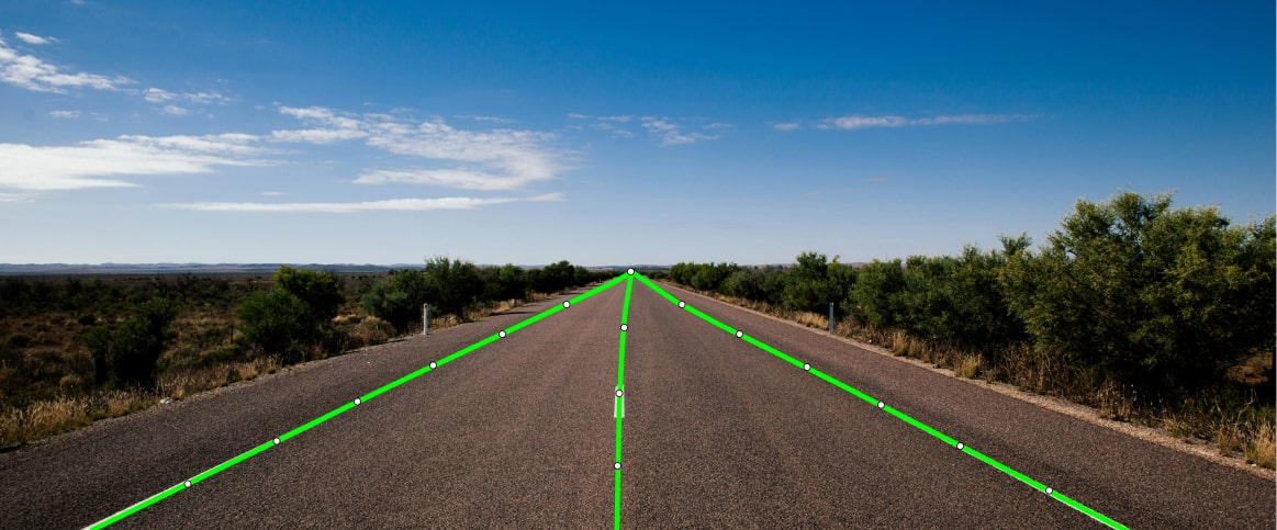

Access labeled maps for better transport planning.
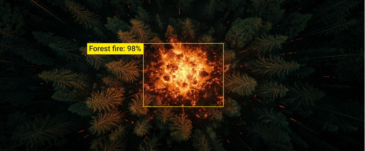

Use annotated data for effective crisis response.


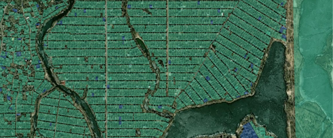
Optimize crop management with precise labeled data.
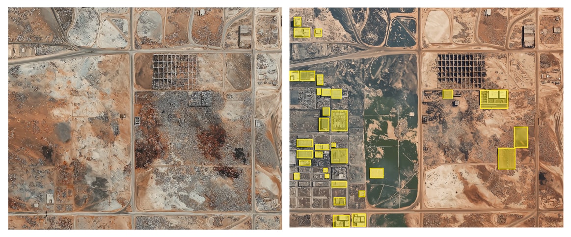
Plan zoning and infrastructure with detailed annotations.
Gain accurate land use insights with annotated data.
Access labeled maps for better transport planning.
Use annotated data for effective crisis response.
Optimize crop management with precise labeled data.
Plan zoning and infrastructure with detailed annotations.
How It Works
Free Pilot
Submit your GIS dataset for a free labeling trial with no obligations.
QA
Review pilot results to confirm accuracy and alignment with your requirements.
Proposal
Get a customized plan designed to meet your specific labeling needs.
Start Labeling
Kick off the labeling workflow with our experts to streamline your GIS project.
Delivery
Receive labeled data on time, ensuring efficiency and budget alignment.
Calculate Your Cost
Estimates 
Send your sample data to get the precise cost FREE
Reviews
What Our Clients Say


Label Your Data has successfully collected data from public sources, annotated missing skeletons, and validated pre-annotations for almost 15,000 images. Although their instructions are sometimes unclear, the team has received praise for their flexibility and speed. They also communicate via email.
Jack Prescott
Software Engineer, Nex
Label Your Data has delivered high-quality data labels, which have received positive client feedback. Their team produces outputs on time and solves challenges without upselling. They also communicate effectively through virtual meetings.
Ben Niehaus
CTO, SpexAI GmbH
Label Your Data's support has been crucial in developing the client's computer vision perception algorithms. They lead a simple and effective collaboration by responding quickly to concerns and questions and delivering everything on time.
Piotr Swierczynski
Director of Engineering, NODAR
Label Your Data provided the client with high-quality annotations and added to the number of annotations in the client's portfolio. The team was consistently available for questions or updates that needed to be added to the data set. The client was impressed with the team's communication skills.
Josha Bharadwa
Software Architect, Searidge Technologies
Label Your Data continues to work diligently for the client. They consistently provide training data for different document types and languages. Furthermore, they are excellent communicators and collaborators, and their ability to serve high-quality services is outstanding.
Luca van Skyhawk
VP of Customer Success, Hypatos GmbH
After engaging with Label Your Data, the client has seen a reduction in error rate and success with model accuracy running on production. The team delivered on time and was communicative in their approach. The client was impressed with the steps Label Your Data took to ensure accurate QA testing.
Radouane Kaddari
Machine Learning Engineer, Peter Park
Why AI Teams Choose Label Your Data
Data Annotation for Complex Environments
Rely on consistent, high-quality output for complex datasets, detailed taxonomies, and edge cases.
Structured Quality from Pilot to Production
Get quality engineered into every step through onboarding, evolving guidelines, QA, and continuous feedback.
Flexible and Scalable Operations
Adjust team capacity, project size, and delivery model as you scale, with no setup fees or long-term lock-ins.
An Integrated Delivery Partner
Align on goals, workflows, and expectations with a team that integrates into your process from day one.
Projects Led by Annotation Experts
Work with former annotators who understand annotation complexity, quality standards, and high-volume delivery.
Request a pilot
Tell us more about your project and data
Thank you for contacting us!
We'll get back to you shortly
After running pilots with several annotation providers, Label Your Data delivered the strongest results by a clear margin, standing out on turnaround time, annotation quality, and the responsiveness of their feedback loops.
Maxime Debarbat
Senior ML Engineer (GenAI)
Trusted by ML Professionals
FAQs
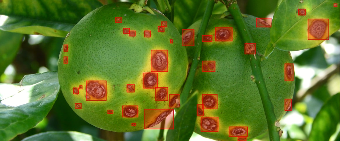
What is annotation in GIS?
Annotation in GIS refers to adding text or symbols to maps to label features like roads, landmarks, or boundaries. It helps provide context and improves map readability.
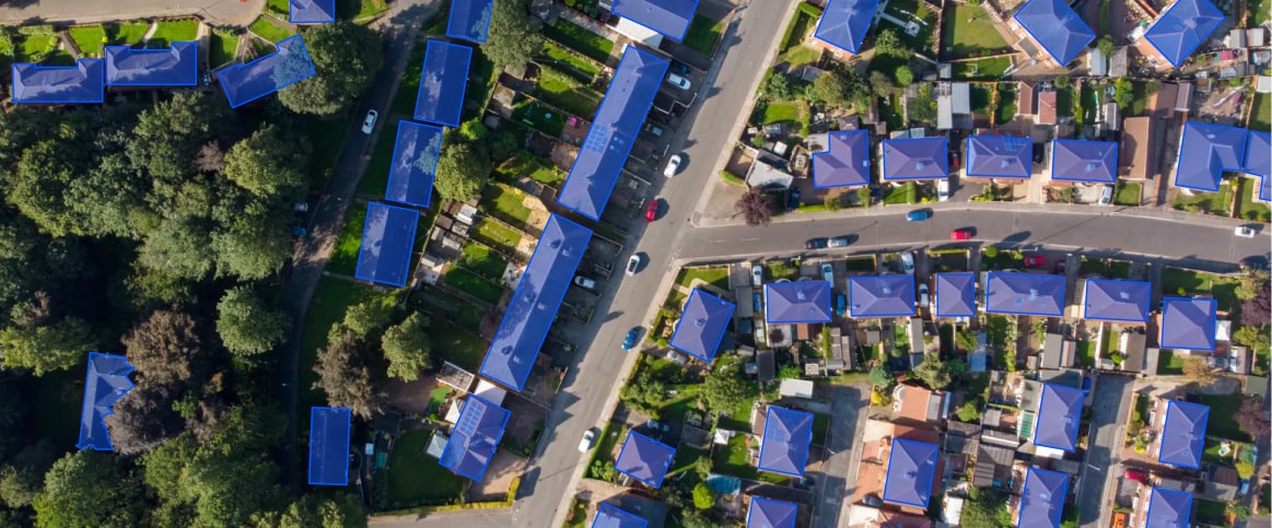
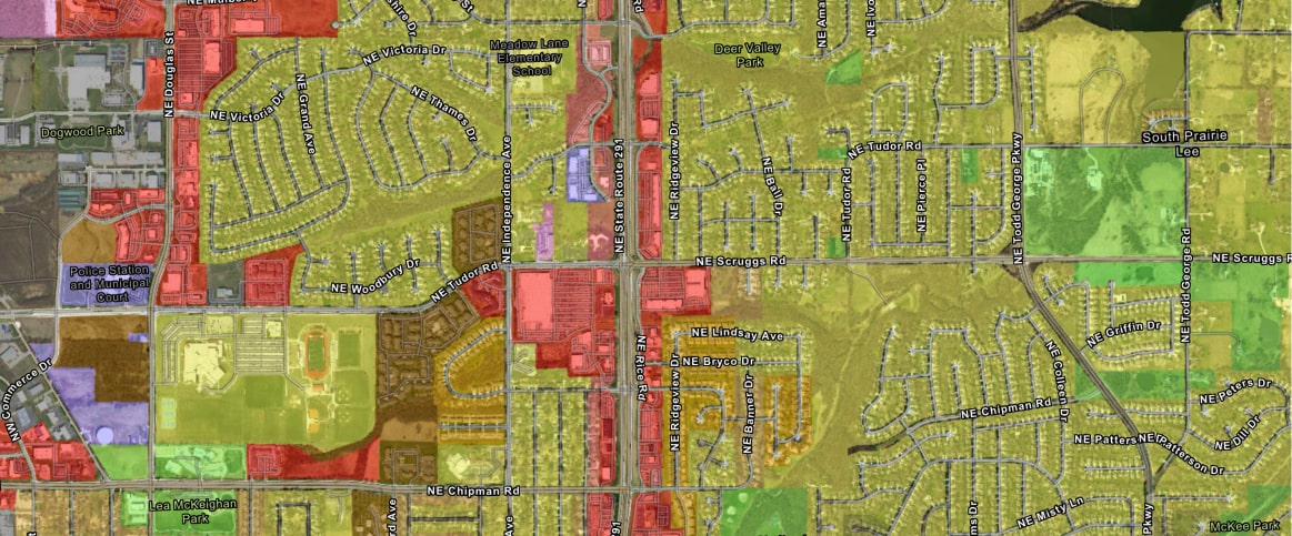
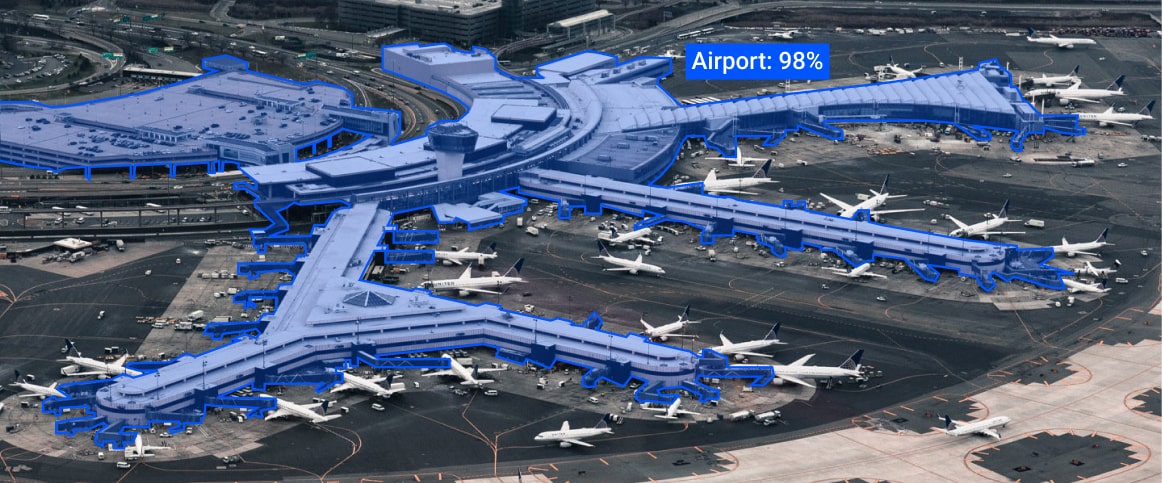
What types of GIS data can Label Your Data annotate?
We can annotate a variety of geospatial data, including satellite imagery, aerial photographs, LiDAR data, and more, tailored to your specific use case. Our services are flexible, ensuring we can meet the unique needs of your project.
How does Label Your Data handle sensitive geospatial information?
We prioritize data security by implementing strict confidentiality measures, secure workflows, and compliance with industry standards to protect your sensitive geospatial data. We are a data-certified vendor: PCI DSS Level 1, ISO:27001, GDPR, and CCPA, ensuring the highest level of data protection and compliance.