-
Services
computer vision
self-serve
- Industries
- Pricing
- About
- Careers
-
Resources
- talk to us
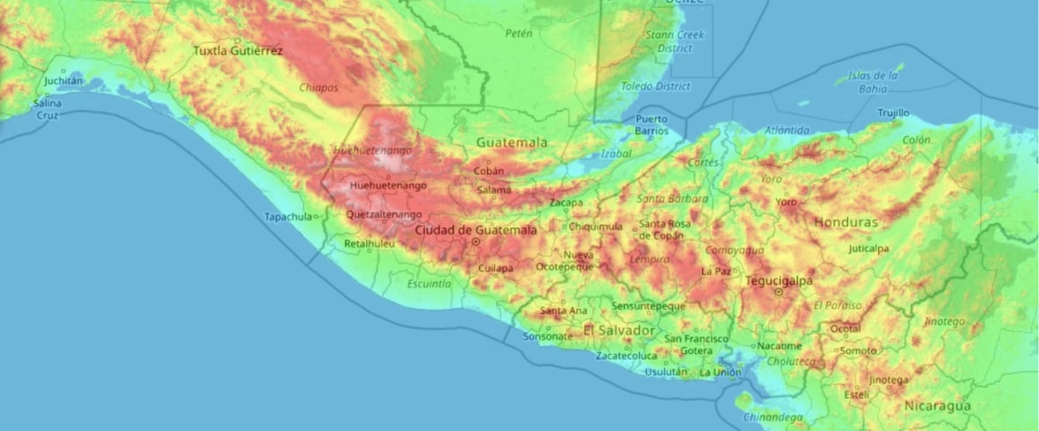
Geospatial
Annotation
Accurately interpret and label complex, location-specific data.
RUN FREE PILOTTrusted by 200+ Customers


Challenges We Solve
ML Engineers
LiDAR mislabels reduce model accuracy
Terrain variations lost in low-resolution annotations
Data Scientists
Route mapping lacks precision for optimization
Inconsistent annotations distort geospatial analysis
Geospatial Companies
Inaccurate crop boundaries affect yield forecasts
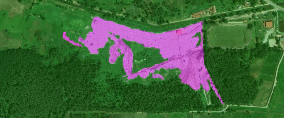
Gaps in drone imagery slow automated monitoring
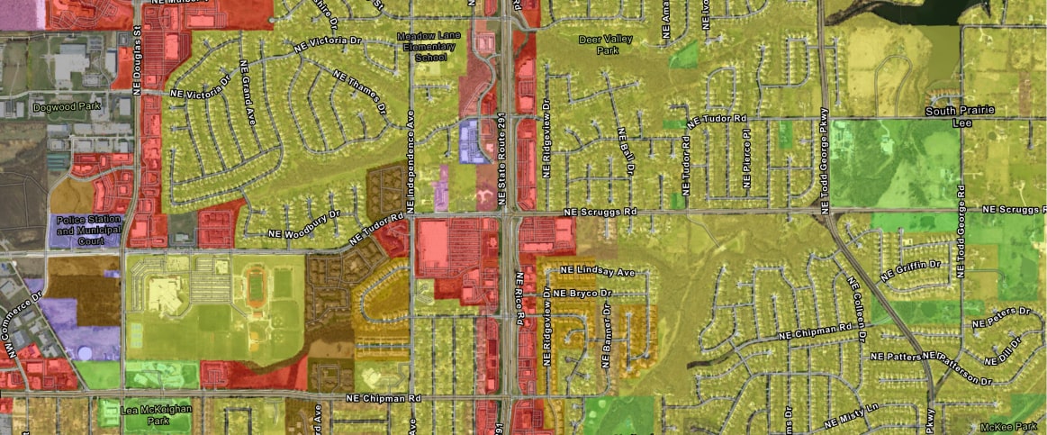
GIS Specialists
3D map distortions hinder disaster response planning
Inconsistent geospatial labels reduce mapping accuracy
Geospatial Annotation Use Cases
Annotate sensor data for safe navigation.
Map infrastructure for better city designs.
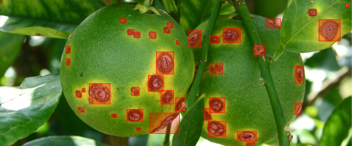

Monitor crop health to optimize yields.
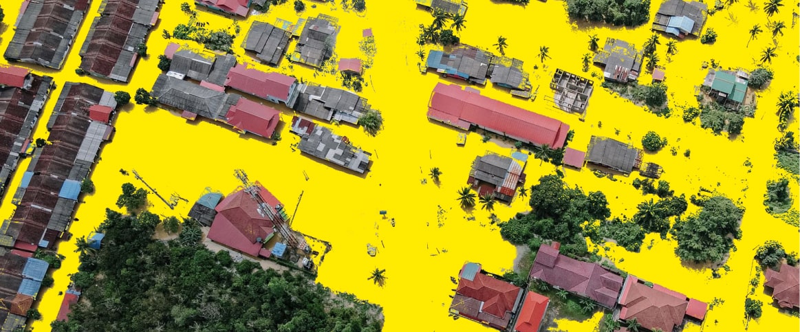
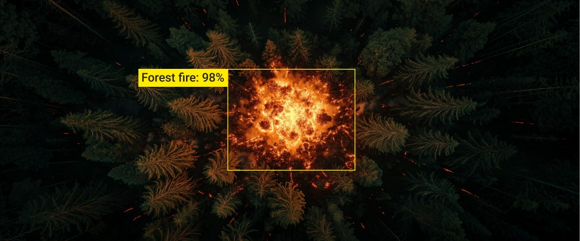
Assess damage for swift emergency response.
Enhance location accuracy for optimal routing.
Annotate sensor data for safe navigation.
Map infrastructure for better city designs.
Monitor crop health to optimize yields.
Assess damage for swift emergency response.
Enhance location accuracy for optimal routing.
How It Works
Free Pilot
Request a free sample to evaluate our geospatial annotation quality.
QA
Examine the annotated sample for accuracy and suitability.
Proposal
Get a personalized annotation project outline.
Annotation Process
Our team labels geospatial data at scale with precision.
Final Product
Receive precisely annotated geospatial data ready to implement.
Calculate Your Cost
Estimates 
Send your sample data to get the precise cost FREE
Reviews
What Our Clients Say


Label Your Data has successfully collected data from public sources, annotated missing skeletons, and validated pre-annotations for almost 15,000 images. Although their instructions are sometimes unclear, the team has received praise for their flexibility and speed. They also communicate via email.
Jack Prescott
Software Engineer, Nex
Label Your Data has delivered high-quality data labels, which have received positive client feedback. Their team produces outputs on time and solves challenges without upselling. They also communicate effectively through virtual meetings.
Ben Niehaus
CTO, SpexAI GmbH
Label Your Data's support has been crucial in developing the client's computer vision perception algorithms. They lead a simple and effective collaboration by responding quickly to concerns and questions and delivering everything on time.
Piotr Swierczynski
Director of Engineering, NODAR
Label Your Data provided the client with high-quality annotations and added to the number of annotations in the client's portfolio. The team was consistently available for questions or updates that needed to be added to the data set. The client was impressed with the team's communication skills.
Josha Bharadwa
Software Architect, Searidge Technologies
Label Your Data continues to work diligently for the client. They consistently provide training data for different document types and languages. Furthermore, they are excellent communicators and collaborators, and their ability to serve high-quality services is outstanding.
Luca van Skyhawk
VP of Customer Success, Hypatos GmbH
After engaging with Label Your Data, the client has seen a reduction in error rate and success with model accuracy running on production. The team delivered on time and was communicative in their approach. The client was impressed with the steps Label Your Data took to ensure accurate QA testing.
Radouane Kaddari
Machine Learning Engineer, Peter Park
Why AI Teams Choose Label Your Data
Data Annotation for Complex Environments
Rely on consistent, high-quality output for complex datasets, detailed taxonomies, and edge cases.
Structured Quality from Pilot to Production
Get quality engineered into every step through onboarding, evolving guidelines, QA, and continuous feedback.
Flexible and Scalable Operations
Adjust team capacity, project size, and delivery model as you scale, with no setup fees or long-term lock-ins.
An Integrated Delivery Partner
Align on goals, workflows, and expectations with a team that integrates into your process from day one.
Projects Led by Annotation Experts
Work with former annotators who understand annotation complexity, quality standards, and high-volume delivery.
Request a pilot
Tell us more about your project and data
Thank you for contacting us!
We'll get back to you shortly
After running pilots with several annotation providers, Label Your Data delivered the strongest results by a clear margin, standing out on turnaround time, annotation quality, and the responsiveness of their feedback loops.
Maxime Debarbat
Senior ML Engineer (GenAI)
Trusted by ML Professionals
FAQs
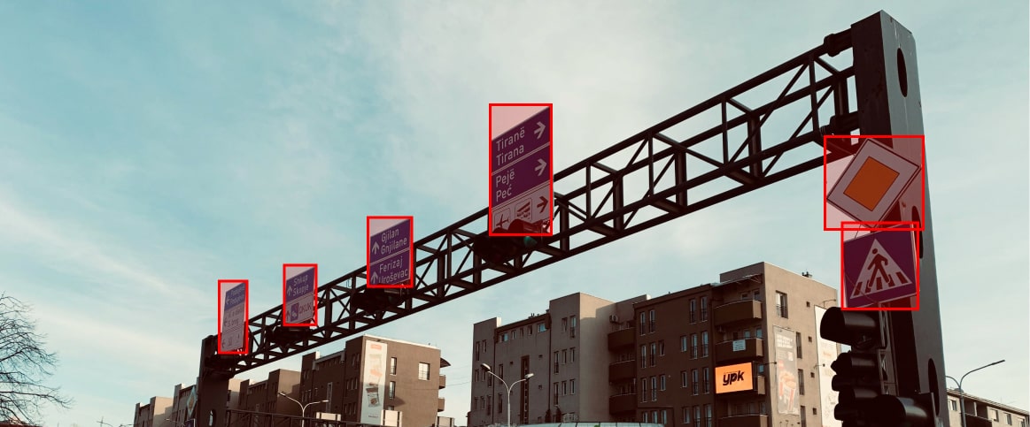
What is geospatial annotation?
It’s the process of labeling satellite, drone, and LiDAR data to make it usable for AI, mapping, and automation. This includes marking objects, classifying land use, or outlining roads and buildings, so machines can understand spatial data.
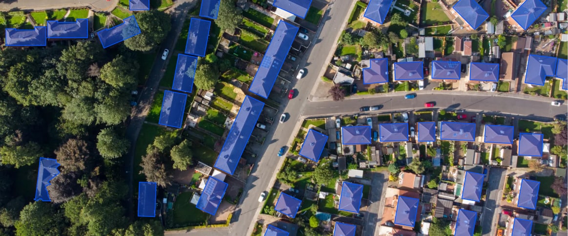
What are geospatial data services?
Geospatial data services involve collecting, processing, and analyzing spatial data from sources like satellites, drones, and LiDAR. These services help create accurate maps, support AI models, and improve decision-making in industries like urban planning, agriculture, and disaster response.
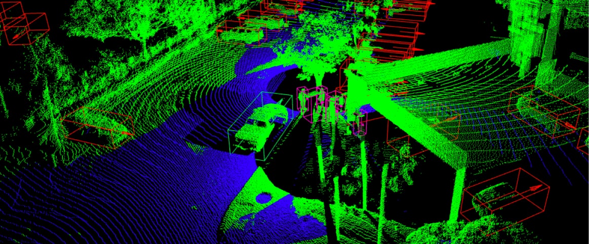
What is LiDAR annotation?
LiDAR annotation involves labeling 3D point cloud data to detect objects, map terrain, and improve AI models. It’s used for self-driving cars, city planning, and environmental monitoring to help machines interpret depth and distance.
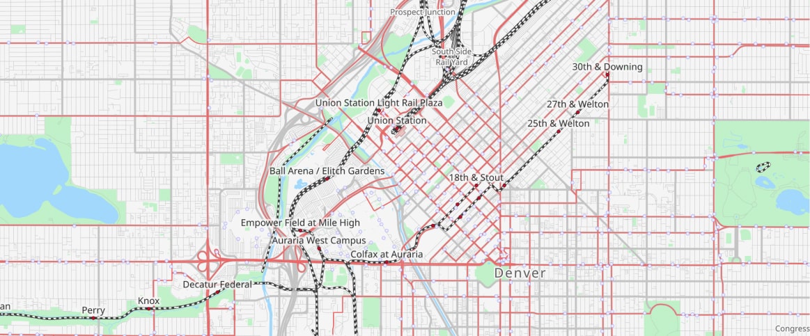
What is annotation in GIS?
In GIS, annotation refers to labeling map features with text, symbols, or graphics to make spatial data easier to understand. This can include road names, elevation markers, or boundaries that help users interpret geographic information.
Do you support LiDAR and 3D point cloud annotation?
Yes, we annotate LiDAR and 3D point cloud data using point classification, 3D bounding boxes, and segmentation to ensure accuracy and reliability. Learn more about our 3D annotation services.