Start Free Pilot

fill up this form to send your pilot request

Email is not valid.

Email is not valid

Phone is not valid

Some error text

Referrer domain is wrong

Thank you for contacting us!

Thank you for contacting us!

We'll get back to you shortly

TU Dublin Quotes

Label Your Data were genuinely interested in the success of my project, asked good questions, and were flexible in working in my proprietary software environment.

Quotes
TU Dublin
Kyle Hamilton

Kyle Hamilton

PhD Researcher at TU Dublin

Trusted by ML Professionals

Trusted by ML Professionals

3D Annotation Services

Prepare your 3D point cloud data with RADAR, photogrammetry, or LiDAR annotation for spatial AI tasks.

RUN FREE PILOT
3D Annotation Services

Trusted by 100+ Customers

ABB – ASEA Brown Boveri
Uipath
Yale
Bizerba
George Washington University
Toptal
Miami University
Hypatos
NEX
ABB – ASEA Brown Boveri
Uipath
Yale
Bizerba
George Washington University
Toptal
Miami University
Hypatos
NEX
ABB – ASEA Brown Boveri
Uipath
Yale
Bizerba
George Washington University
Toptal
Miami University
Hypatos
NEX

Use Cases for

ML Engineers

ML Engineers

?= $text ?>

Developing 3D models for object detection and segmentation tasks

?= $text ?>

Facing lengthy in-house annotation processes for complex 3D data

Dataset Providers

Dataset Providers

?= $text ?>

Delivering annotated 3D datasets to clients

?= $text ?>

Need consistent, high-quality LiDAR annotations on demand

AI-Powered Businesses

AI-Powered Businesses

?= $text ?>

Using 3D data for autonomous navigation or inspections

?= $text ?>

Struggling to manage growing data volumes needing annotation

Academic Researchers

Academic Researchers

?= $text ?>

Requiring detailed 3D labeling for advanced spatial research

?= $text ?>

Limited by time and resources for manual point annotation

Discuss your challenges

Check Your 3D Image Annotation Needs

Autonomous Driving

Autonomous Driving

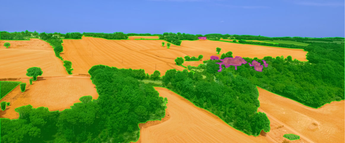
Drone and Aerial Surveys

Drone and Aerial Surveys

Urban Planning

Urban Planning

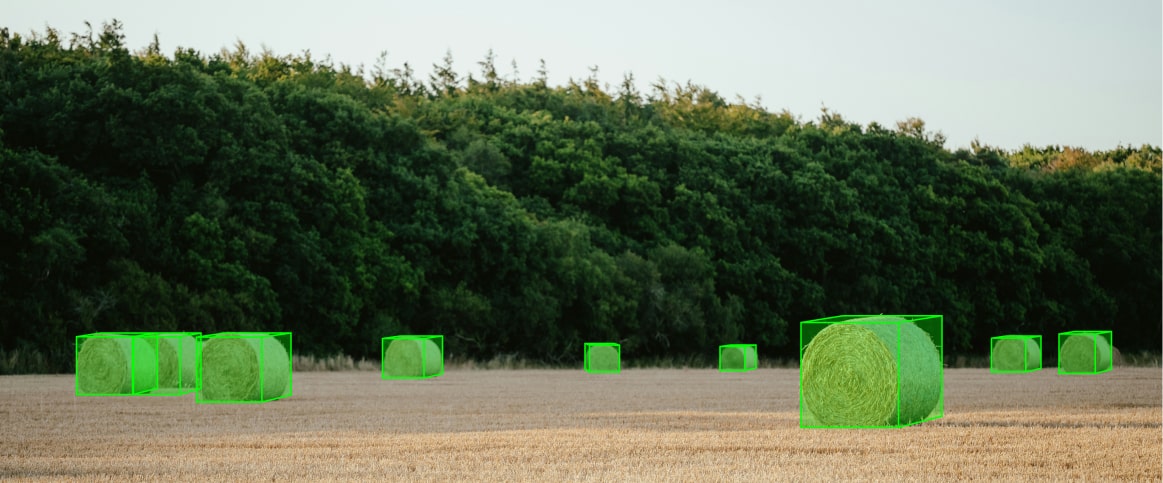
Precision Agriculture

Precision Agriculture

Environmental Monitoring

Environmental Monitoring

Warehouse Automation

Warehouse Automation

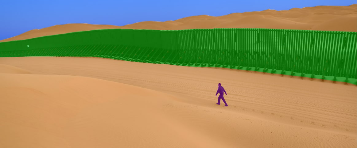
Defense and Security

Defense and Security

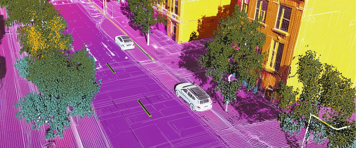
An example of 3d cuboid annotation for autonomous driving
Label LiDAR and RADAR data for vehicle, pedestrian, and road sign detection.
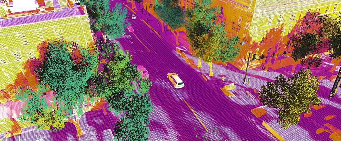
3D-cuboids 3D-cuboids
Semantic segmentation Semantic segmentation

Label LiDAR and RADAR data for vehicle, pedestrian, and road sign detection.
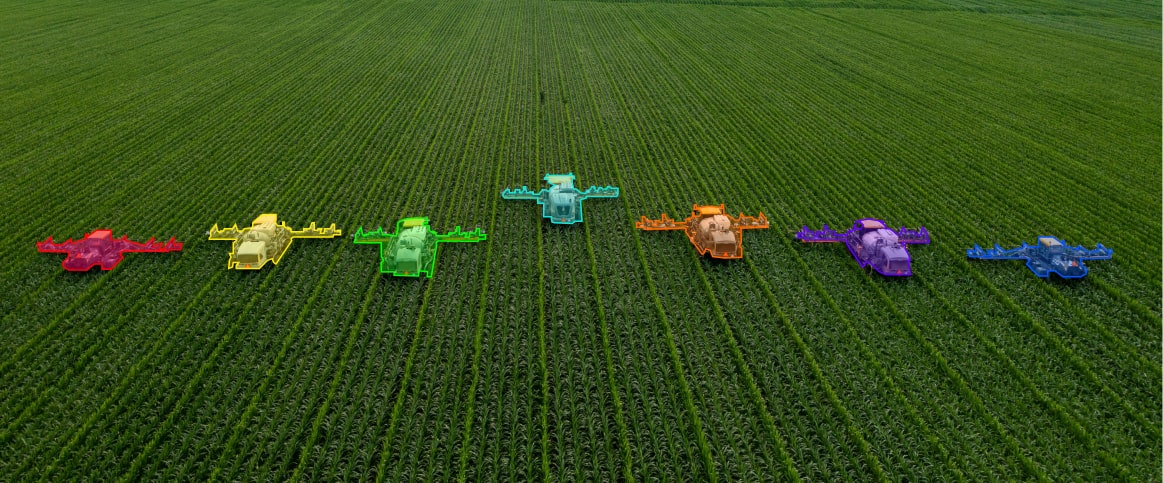
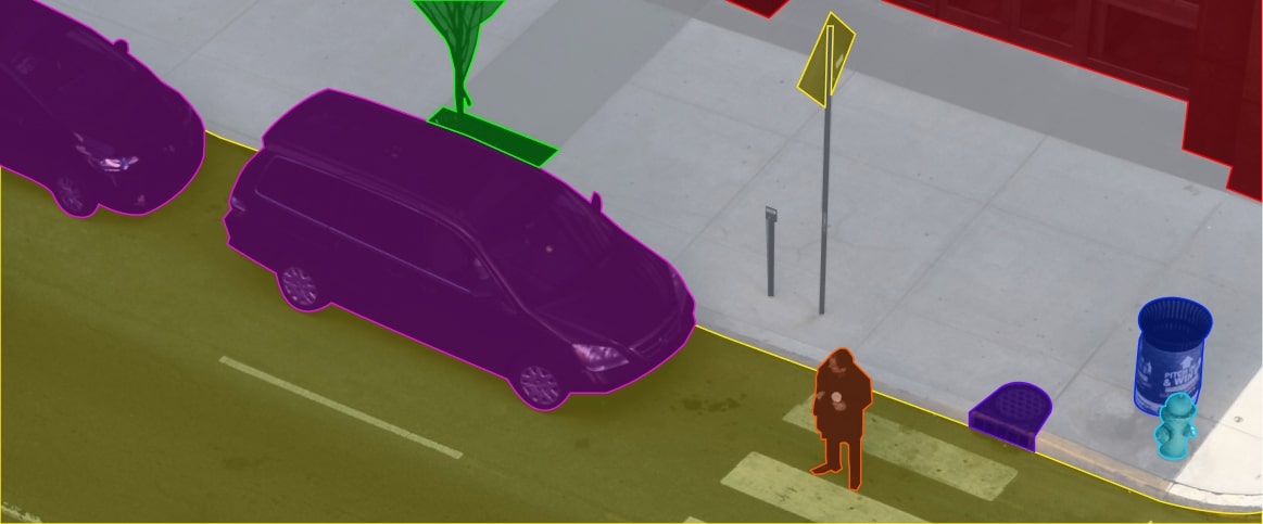
An example of semantic segmentation for drone and aerial surveys
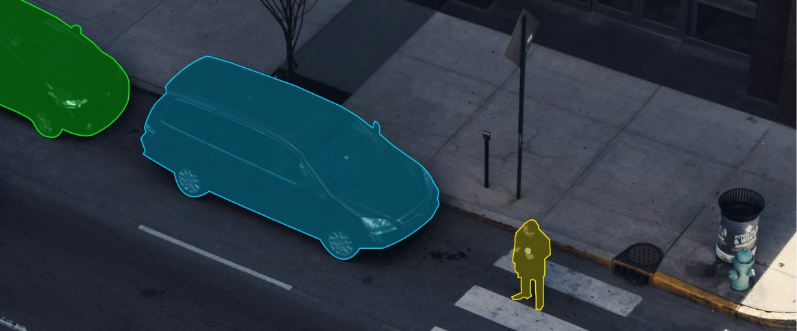
An example of instance segmentation for drone and aerial surveys
An example of polygon annotation for drone and aerial surveys
Semantic segmentation Semantic segmentation
Instance segmentation Instance segmentation
Polygon Annotation Polygon Annotation

Annotate photogrammetry and LiDAR for land use, infrastructure, and environmental analysis.

An example of 3d cuboid annotation for urban planning
An example of semantic segmentation for urban planning
An example of instance segmentation for urban planning
3D Cuboids 3D Cuboids
Semantic segmentation Semantic segmentation
Instance segmentation Instance segmentation

Label 3D data to model cityscapes and optimize infrastructure.

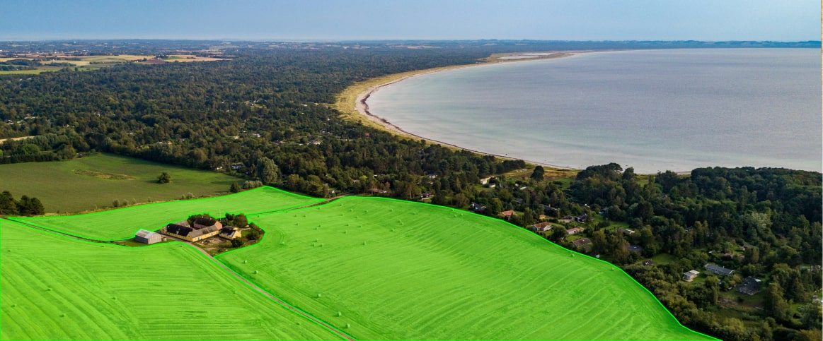
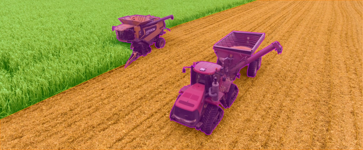
An example of semantic segmentation for precision agriculture
An example of instance segmentation for urban planning
An example of 3d cuboid annotation for precision agriculture
Semantic segmentation Semantic segmentation
Polygon Annotation Polygon Annotation
3D Cuboids 3D Cuboids

Annotate LiDAR or RADAR data to monitor crops and analyze vegetation.

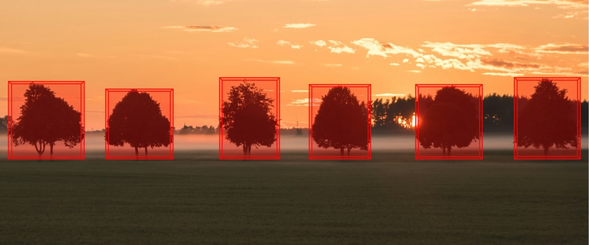
An example of 3d annotation for environmental monitoring
An example of semantic segmentation for environmental monitoring
An example of polygon annotation for environmental monitoring
3D Cuboids 3D Cuboids
Semantic segmentation Semantic segmentation
Polygon Annotation Polygon Annotation

Process point cloud data for terrain, deforestation, and ecosystem mapping.

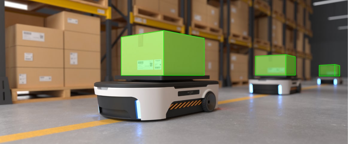
An example of 3d annotation for warehouse automation
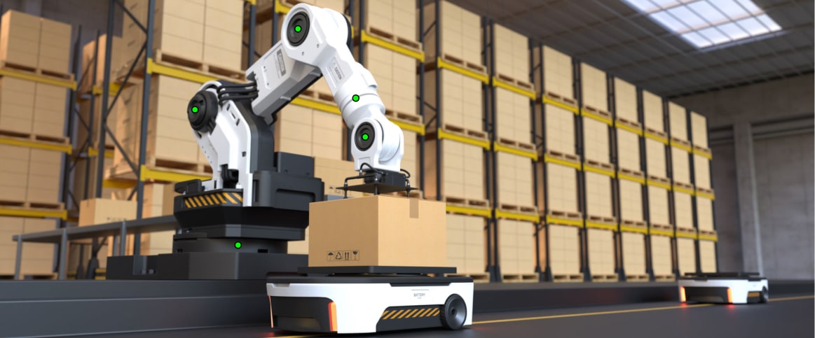
An example of keypoint annotation for warehouse automation
3D Cuboids 3D Cuboids
Keypoint Annotation Keypoint Annotation

Label RADAR and LiDAR for robot training and inventory management.

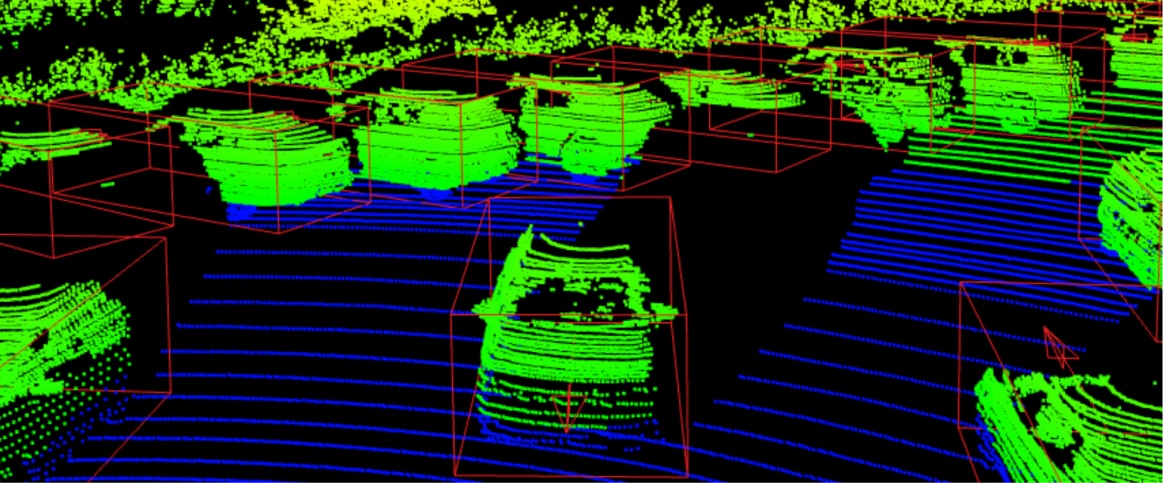
An example of 3d annotation for defense and security
An example of instance segmentation for defense and security
An example of semantic segmentation for defense and security
3D Cuboids 3D Cuboids
Semantic segmentation Semantic segmentation
Polygon Annotation Polygon Annotation

Annotate 3D data for surveillance and obstacle detection.

Autonomous Driving

Autonomous Driving

svg
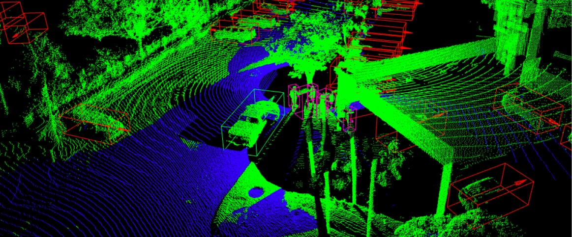
An example of 3d cuboid annotation for autonomous driving
Label LiDAR and RADAR data for vehicle, pedestrian, and road sign detection.
3D-cuboids 3D-cuboids
Semantic segmentation Semantic segmentation

Label LiDAR and RADAR data for vehicle, pedestrian, and road sign detection.

Drone and Aerial Surveys

Drone and Aerial Surveys

svg
An example of semantic segmentation for drone and aerial surveys
An example of instance segmentation for drone and aerial surveys
An example of polygon annotation for drone and aerial surveys
Semantic segmentation Semantic segmentation
Instance segmentation Instance segmentation
Polygon Annotation Polygon Annotation

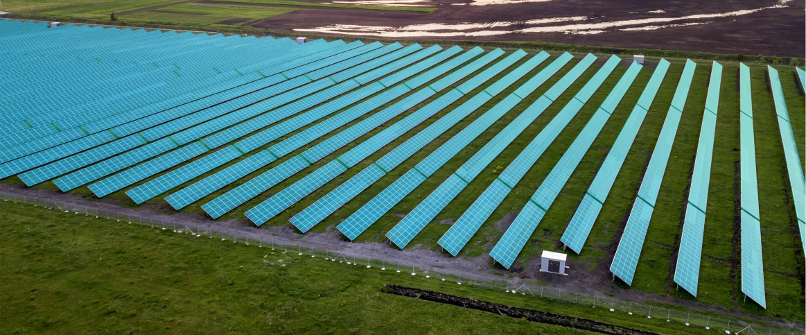
Annotate photogrammetry and LiDAR for land use, infrastructure, and environmental analysis.
Urban Planning

Urban Planning

svg
An example of 3d cuboid annotation for urban planning
An example of semantic segmentation for urban planning
An example of instance segmentation for urban planning
3D Cuboids 3D Cuboids
Semantic segmentation Semantic segmentation
Instance segmentation Instance segmentation

Label 3D data to model cityscapes and optimize infrastructure.
Precision Agriculture

Precision Agriculture

svg
An example of semantic segmentation for precision agriculture
An example of instance segmentation for urban planning
An example of 3d cuboid annotation for precision agriculture
Semantic segmentation Semantic segmentation
Polygon Annotation Polygon Annotation
3D Cuboids 3D Cuboids

Annotate LiDAR or RADAR data to monitor crops and analyze vegetation.
Environmental Monitoring

Environmental Monitoring

svg
An example of 3d annotation for environmental monitoring
An example of semantic segmentation for environmental monitoring
An example of polygon annotation for environmental monitoring
3D Cuboids 3D Cuboids
Semantic segmentation Semantic segmentation
Polygon Annotation Polygon Annotation

Process point cloud data for terrain, deforestation, and ecosystem mapping.
Warehouse Automation

Warehouse Automation

svg
An example of 3d annotation for warehouse automation
An example of keypoint annotation for warehouse automation
3D Cuboids 3D Cuboids
Keypoint Annotation Keypoint Annotation

Label RADAR and LiDAR for robot training and inventory management.

Defense and Security

Defense and Security

svg
An example of 3d annotation for defense and security
An example of instance segmentation for defense and security
An example of semantic segmentation for defense and security
3D Cuboids 3D Cuboids
Semantic segmentation Semantic segmentation
Polygon Annotation Polygon Annotation

Annotate 3D data for surveillance and obstacle detection.
How It Works

Step 1

Free Pilot

Send us your 3D point cloud data sample for free annotation to assess our quality.

Step 2

QA

Review the pilot results to see if we meet your quality standards and fit your budget.

Step 3

Proposal

Receive a customized proposal based on your specific 3D annotation needs.

Step 4

Start Annotation

Begin the LiDAR data annotation with our expert team to enhance your model.

Step 5

Delivery

Receive your annotated 3D point cloud data on time to keep your project on track.

Calculate Your Cost
Estimates line

1 Pick application field
2 Select annotation method
3 Specify how many objects to label
4 Check the approximate total cost
5 Run free pilot
Select Annotation Method
Amount
0 1M
Estimated Cost
$ x entities
$
RUN FREE PILOT

Send your sample data to get the precise cost FREE

Reviews

What Our Clients Say

Stars "We were impressed by the labeled data quality as well."

Label Your Data makes significant progress toward the goal of enhancing the client’s algorithm performance. The team works quickly to deliver annotations and annotators with extensive experience in the field. Their project management is straightforward, making for a smooth engagement.

Stars "They’re willing to drop everything to fulfill our needs and keep us happy."

Demonstrating a profound dedication to the project, Label Your Data consistently provides near-perfect deliverables at a cost-effective price. Thanks to their help, the client has been able to be more flexible with their work. Their impressive turnaround time further enhances the solid partnership.

Stars "Their flexibility and ability to work with multiple languages are impressive."

LYD showed high quality and flexibility and convinced us from day one with their high passion for delivering a great service. We currently evaluate further possibilities to further involve them in our initiatives and projects.

Stars “I’m impressed with how easy our communication with the team is and how simple and effective the processes are."

Label Your Data’s support has been crucial in developing the client’s computer vision perception algorithms.

Stars "The Label Your Data team was always available for questions."

Label Your Data provided the client with high-quality annotations and added to the number of annotations in the client’s portfolio. The team was consistently available for questions or updates that needed to be added to the data set.

Stars "They are flexible, dedicated, and their processes are well organized."

Label Your Data sends out weekly data annotation for the client to review. So far, the platform hasn’t had any issues and they are focusing on enhancing the platform since it was launched in November 2020. Their expertise shows productive results as the project progresses.

Why Projects Choose Label Your Data

No Commitment

No Commitment

Check our performance based on a free trial

Flexible Pricing

Flexible Pricing

Pay per labeled object or per annotation hour

Tool-Agnostic

Tool-Agnostic

Working with every annotation tool, even your custom tools

Data Compliance

Data Compliance

Work with a data-certified vendor: PCI DSS Level 1, ISO:2700, GDPR, CCPA

Start Free Pilot

fill up this form to send your pilot request

Email is not valid.

Email is not valid

Phone is not valid

Some error text

Referrer domain is wrong

Thank you for contacting us!

Thank you for contacting us!

We'll get back to you shortly

TU Dublin Quotes

Label Your Data were genuinely interested in the success of my project, asked good questions, and were flexible in working in my proprietary software environment.

Quotes
TU Dublin
Kyle Hamilton

Kyle Hamilton

PhD Researcher at TU Dublin

Trusted by ML Professionals

Trusted by ML Professionals

FAQs

Do I need to commit to a long-term contract?

Not at all. We offer 3 flexible pricing options:

Short term for one-off projects like academic research
On-demand for seasonal projects when you need additional workforce
Long term for a streamlined data annotation workflow

What is your pricing?

We calculate according to how much time is spent on your object annotation. That’s why the pilot project is also valuable for us – we get to calculate the expenses

When can I start the free pilot?

As soon as we clarify details on your dataset. You’ll get a reply within this or the next work day.

Do you work with our labeling tools?

Absolutely! We’re flexible with any tools you want us to work in.

How can I trust you with my confidential data?

We earned several data compliance certificates to prove our dedication to data security:

PCI DSS Level 1
ISO:27001
GDPR
CCPA

After we sign the NDA, we make sure to anonymize your data for our employees to prevent any data leaks.

What is 3D point cloud annotation?

3D point cloud annotation is the process of labeling individual data points in a 3D space. Such data is generated by LiDAR, RADAR, or photogrammetry. This annotation type helps ML models recognize and interpret objects, boundaries, and spatial relationships in 3D scenes for applications like autonomous navigation and environmental monitoring.

How to label a 3D point cloud?

To label 3D point cloud data, you must identify and mark objects, boundaries, or features within the three-dimensional data. Techniques include segmentation, bounding boxes, and classification. Our expert team at Label Your Data uses advanced LiDAR annotation tools to accurately label complex 3D data for precise object detection and spatial analysis.

What is 3D LiDAR annotation?

LiDAR data annotation is the specific process of labeling data points collected from LiDAR sensors. It is essential for applications that require accurate depth perception and spatial awareness. Think of self-driving cars and urban planning. By annotating this data, Label Your Data enhances model accuracy for safe and reliable performance in these fields.

RUN FREE PILOT